
Contour Model Kit
Discover the fascinating science of cartography and terrain mapping with this hands-on topographical map creation kit. While early explorers relied on accurate maps to navigate uncharted territories, elevation was always difficult to represent. This kit demonstrates how contour lines connect areas of equal elevation, revealing the hidden topography of mountains, valleys, and terrain features through systematic water-level mapping.
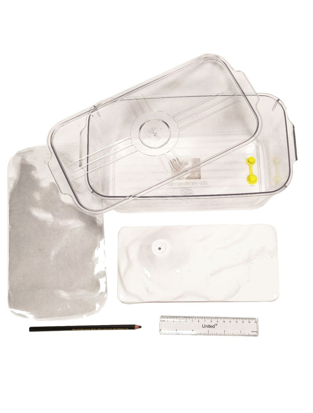
The complete kit features a durable 11¼” x 6” x 3½” Polyethylene terephthalate (PET) container with an integrated lid and convenient drain plug, designed to hold the included polystyrene landform model. Students pour water into the container to reveal elevation levels, then trace each waterline onto clear PET transparency sheets to create authentic contour maps. This hands-on process illustrates how professional cartographers translate complex terrain into readable topographical maps.
Perfect for geography, earth science, and STEM projects, this kit accommodates groups of up to 5 students and includes
all the essential materials: 5 clear PET tracing sheets, a black wax pencil, a 6-inch ruler, and a comprehensive activity guide. The guide extends learning beyond the classroom with online resources for exploring local topographical maps, connecting classroom concepts to real-world applications.
- Complete cartography kit for hands-on map creation
- Demonstrates contour line principles through water-level tracing
- Includes polystyrene landform model and precision container
- Accommodates 5-student groups with all materials provided
- Includes activity guide

Discover the fascinating science of cartography and terrain mapping with this hands-on topographical map creation kit. While early explorers relied on accurate maps to navigate uncharted territories, elevation was always difficult to represent. This kit demonstrates how contour lines connect areas of equal elevation, revealing the hidden topography of mountains, valleys, and terrain features through systematic water-level mapping.
The complete kit features a durable 11¼” x 6” x 3½” Polyethylene terephthalate (PET) container with an integrated lid and convenient drain plug, designed to hold the included polystyrene landform model. Students pour water into the container to reveal elevation levels, then trace each waterline onto clear PET transparency sheets to create authentic contour maps. This hands-on process illustrates how professional cartographers translate complex terrain into readable topographical maps.
Perfect for geography, earth science, and STEM projects, this kit accommodates groups of up to 5 students and includes
all the essential materials: 5 clear PET tracing sheets, a black wax pencil, a 6-inch ruler, and a comprehensive activity guide. The guide extends learning beyond the classroom with online resources for exploring local topographical maps, connecting classroom concepts to real-world applications.